
Obj. ID: 49443
Jewish Funerary Art Jewish cemetery in Chełm, Poland
According to ESJF European Jewish Cemeteries Initiative, the Jewish cemetery was most likely founded toward the end of the 15th century, approximately 1 km north of the town centre. Its age can be approximated by a tombstone discovered in 2019 dating back to 1514. According to city plans from 1823, the cemetery was roughly shaped like an elongated rectangle with an east-west axis, with small additional grounds on the southeast corner, and had an acreage of 15,850 square metres in 1829. Its area was in time expanded several times. Toward the end of the 19th century, the local government forced the community to close the old and establish a new cemetery. Despite the fact that a plot was purchased by the Jewish Community in 1910, a new cemetery was not founded. In the interwar period, the area of the existing cemetery was expanded in the south and west. During World War II the cemetery was destroyed. German occupying forces used tombstones, forcibly removed by Jews, to pave roads, sidewalks and courtyards in front of offices and the police headquarters. Individual and mass executions were carried out in the cemetery, and it was a burial site for victims of executions across the city.
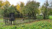
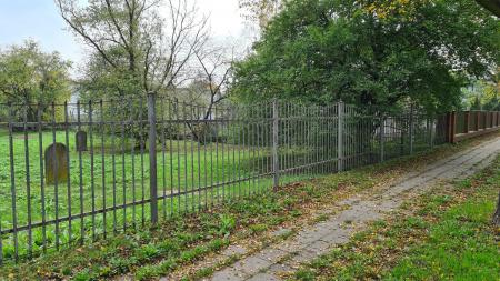
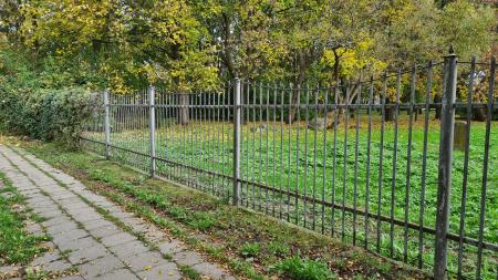
After the war, the cemetery was a burial site for exhumed remains of victims across the town and area, as well as those who died after the war. The stealing of tombstones for other uses was continued by the residents of the town and neighbouring villages. In the 1960s the southern area of the cemetery, where some tombstone remains were preserved, was fenced. The northern area became a square. From the beginning of the 1990s, tombstones found in the city were brought to the cemetery. In 1994, funded by the Nissenbaum family, most of the cemetery was fenced by metal fence with brick posts around 1.8 metres high. An area of approximately 20 meters in the north remained unfenced (a road, lawns, and sidewalk), as well as an area of approximately 20 meters to the east, occupied by a BP petrol station.
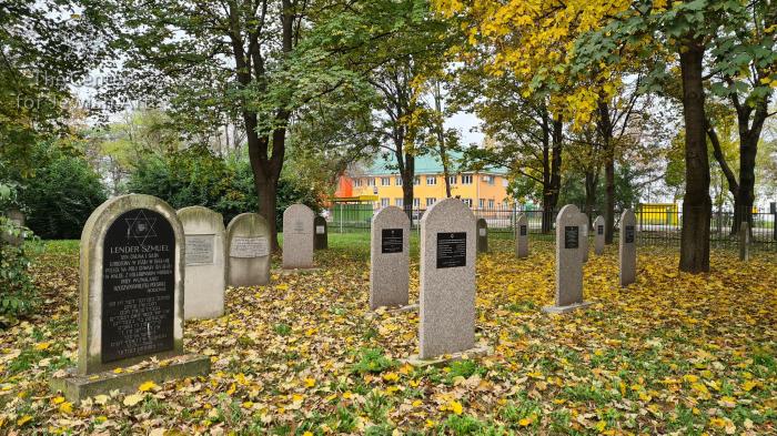
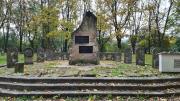
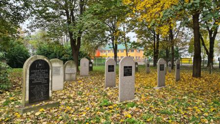
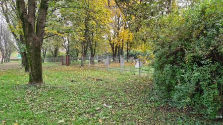
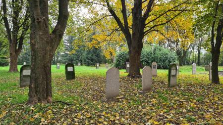
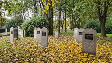
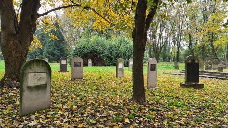
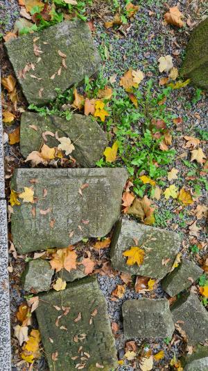
In 1996 a memorial was erected in the central part of the fenced area. It includes concrete stelae with fragments of tombstones placed beside the monument irregularly in the northern part of the fenced part of the cemetery. Tombstones recovered in the 21st century were placed beside the memorial and are slowly falling into disrepair. Since 1995, descendants of Jews from Chełm began to erect concrete, and in time granite, stelae in the northern fenced part of the cemetery, which is dedicated to the memory of their families. This practice continues until today. Erecting memorials in the place of others’ burials does not align with regulations set by the Rabbinic Committee of Cemeteries. Until today, there are approximately 150 remaining tombstones or their fragments, partly in situ, in the southern part of the cemetery, and there are over a hundred tombstones placed beside the memorial. Currently, the cemetery is owned by the city, which maintains the overgrown area.
On the initiative of Rabbi Israel Meir Gabaj from the Ohele Tzadyków society, a tombstone was erected in the alleged resting place of Rabbi Meir Neuhaus, also known as the Tomashover Rebe.
There are 189 gravestones, including 106 reconstructed tombstones (28 of which have fragments of original tombstones embedded in them), 4 original tombstones. There is also a separate place in the cemetery, described as a mass grave, which has 157 fragments of tombstones.


sub-set tree:
| At the intersection of Kolejowa and Starościńska streets, the entrance is between 31 and 35, Kolejowa Street