Home
   Under Reconstruction!
Object Alone

Obj. ID: 50518
Jewish Funerary Art
  Site of the Jewish cemetery in Wyszków, Poland

© ESJF European Jewish Cemeteries Initiative, Photographer: ESJF European Jewish Cemeteries Initiative, 2021

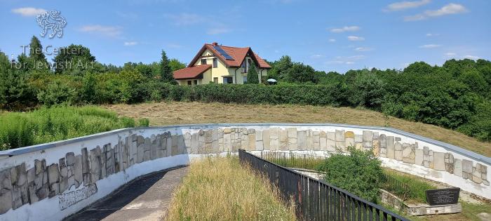
According to ESJF European Jewish Cemeteries Initiative, until the establishment of the cemetery in the 1820s, the Jews of Wyszków and its vicinity were buried in the cemeteries of whichever Jewish community they were subject to at the time. The cemetery was eventually established 1.5 km north-east of the city centre, among fields. It was shaped liked an irregular polygon (like a triangle) with an area of about 4 hectares (ha). In the interwar period, it was enclosed with a brick wall, and it was not covered with trees.

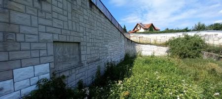
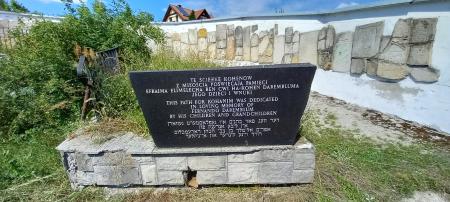
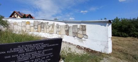
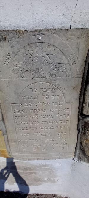
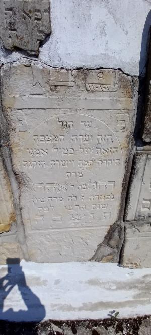
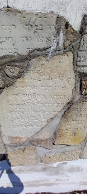
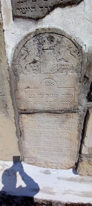
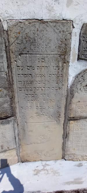
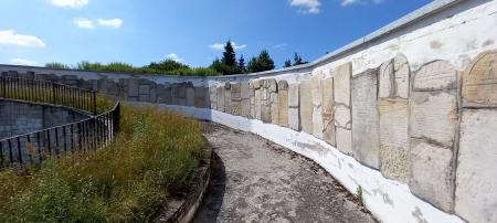
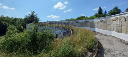
There was a caretaker’s house next to the cemetery. During World War II, the cemetery was totally devastated. The fence was torn down, and the tombstones were taken away for construction purposes. After the Soviet occupation in 1944, the area was plowed, then used as a pasture, farmland, sand mine, and partially built over with residential houses. From the 1990s, tombstones found in the city were gathered and, in 1997, were placed in the lapidary monument in the recovered area of the cemetery (1.5 ha). The wall-shaped lapidarium contains 82 fragments of tombstones. They are traditional stelae made of sandstone, granite, and marble. There is a memorial for the cohen’s section.

Date of oldest tombstone: 1885, 1900 (fragments).
Date of newest tombstone: 1931, 1932 (fragments).
Perimeter length: 619 metres
 
The cemetery area is situated at the southern end of Nadgórska street. A car repair shop, 43 Łączna Street, is located in the southern corner of the historical cemetery area.

Summary and Remarks
Remarks

55 image(s)

sub-set tree:

Name/Title
Site of the Jewish cemetery in Wyszków | Unknown
Object Detail
Monument Setting
Unknown
Date
1820s (Established)
Synagogue active dates
Reconstruction dates
Artist/ Maker
Unknown
Historical Origin
Unknown
Community type
Congregation
Unknown
Location
Building/site does not exist
Poland | Mazowieckie Voivodeship | Wyszków
| At the southern end of Nadgórska street
Site
Unknown
School/Style
Unknown|
Period
Unknown
Period Detail
Collection
Unknown |
Documentation / Research project
Iconographical Subject
Unknown |
Textual Content
Unknown |
Languages of inscription
Unknown
Shape / Form
Unknown
Material / Technique
Material Stucture
Material Decoration
Material Bonding
Material Inscription
Material Additions
Material Cloth
Material Lining
Tesserae Arrangement
Density
Colors
Construction material
Measurements
Height
Length
Width
Depth
Circumference
Thickness
Diameter
Weight
Axis
Panel Measurements
Condition
Extant
Documented by CJA
Surveyed by CJA
Present Usage
Present Usage Details
Condition of Building Fabric
Architectural Significance type
Historical significance: Event/Period
Historical significance: Collective Memory/Folklore
Historical significance: Person
Architectural Significance: Style
Architectural Significance: Artistic Decoration
Urban significance
Significance Rating
0
Ornamentation
Custom
Contents
Codicology
Scribes
Script
Number of Lines
Ruling
Pricking
Quires
Catchwords
Hebrew Numeration
Blank Leaves
Direction/Location
Façade (main)
Endivances
Location of Torah Ark
Location of Apse
Location of Niche
Location of Reader's Desk
Location of Platform
Temp: Architecture Axis
Arrangement of Seats
Location of Women's Section
Direction Prayer
Direction Toward Jerusalem
Coin
Coin Series
Coin Ruler
Coin Year
Denomination
Signature
Colophon
Scribal Notes
Watermark
Hallmark
Group
Group
Group
Group
Group
Trade Mark
Binding
Decoration Program
Suggested Reconsdivuction
History/Provenance
Main Surveys & Excavations
Sources
Type
Documenter
|
Author of description
|
Architectural Drawings
|
Computer Reconstruction
|
Section Head
|
Language Editor
|
Donor
|
Negative/Photo. No.
The following information on this monument will be completed:
Unknown |