Obj. ID: 50344
Jewish Funerary Art Jewish cemetery in Radom, Poland

According to ESJF European Jewish Cemeteries Initiative, in the 1830s, the Jewish community in Radom established a kehilla and, in 1837, a cemetery was established.
In 1831, as a result of a cholera epidemic, the local authorities allowed the Jewish community to establish an epidemic cemetery, which was recognized in 1837 as a communal cemetery. Prior to this, Jews of Radom buried their relatives in the Jewish cemeteries in Przytyk and Kozienice. The cemetery was built about 4 km northeast of the market square, in the village of Dzierzków. In the years 1860, 1902, and 1911, the cemetery was enlarged. Ultimately, the cemetery covered a rectangular plot of land with an area of approximately 5 hectares (which remains the case today). It was enclosed with a brick wall and gate, and the funeral home was located adjacent to the cemetery. During World War I, quarters for Jewish soldiers were established in the cemetery. During World War II, the cemetery was completely destroyed, and the tombstones were used for construction purposes. Numerous Jews killed in the Radom Ghetto were buried in mass graves.
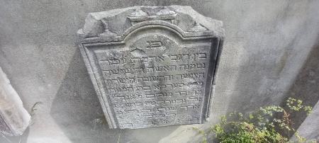
After the war, the cemetery was in use until 1951. In the years 1948–1949, the bodies of Jews exhumed from the neighbouring forced labour camps were reburied there. Since 1989, some restoration work has been done in the cemetery, including re-enclosing it with a brick wall and a gate. A monument in honour of the Jews who fought for Polish independence was erected in the cemetery. Holocaust victims were honoured with a lapidarium and a mausoleum. Tombstones recovered in the city were placed along the main alley of the cemetery, while others were mounted onto the wall and monuments. Tombstones are still being found and placed back in the cemetery. Currently, there are about 400 tombstones in the cemetery, mainly traditional sandstone stelae (the oldest one dates to 1837).
There is a restored ohel, which is used as a memorial. There are information boards at the entrance. There is a brick wall (2-2.5 m high) and an iron gate along the northern border, a concrete wall (2-2.5 m high) with iron decorations in a form of a menorah along the three other sides.
There are 300 gravestones. All present tombstones are not located in their original places. Several dozen fragments are embedded into the interior side of the northern wall, some intact tombstones (68 standing and 30 lying) have been placed in two rows which form an “alley” from the main entrance to the memorial stone at the centre. Dozens of tombstones from the years 1920-1930 are placed in the semicircular wall lapidarium. A list of the tombstones is available at https://tinyurl.com/feehfrkc
The cemetery is located on the plot between Towarowa and Daleka streets. The northern border of the cemetery adjoins a car repair centre at 5, Towarowa Street.